Monday, December 31, 2007

Well, I was going to think of a creative title for this, but I wont: Year 2007 in Review

Well, another year has passed, so quickly by us. Amazing. So many things in 2007. So many milestones. Events. Moments. Memories.

In this year, I have grown academically. From getting a B in January, to learning all about the human condition and philosophy in Humanities and AP European History. From getting a passion in thermodynamics, acid-base musings, and other chemistry stuff, to taking my first AP, SAT II, and SAT I tests. It was a year of growing. It was a year of setbacks. It was a year of overcoming what was deemed "impossible". Perhaps, more than anything this year, the theme is "learning". Not just about the Bronstead Lowry definition of acid/base, or just how to take the second derivative, but basically, learning that it CAN be done. How I survived the gruesome AP Calc exam FRQs, and mock exam MC. How I, after basically knowing nothing after my AP Chem teacher's lectures, turned out an A on the midterm. How I muddled through the reaction quizzes and somehow got a satisfactory score. How I did an AP Physics problem the wrong way, and then after checking, realized that it was wrong, and subsequently did it the right way. How, even though things seemed impossible, it was done. How I got 5's. Finishing the almost 1000-page Western Civilizations book for AP Euro. How, even with only 1 week left to spare till SAT II's, I studied mad and ended up with two scores above 750. How, even with 2 weeks 3 weeks left to spare till SAT I's, I studied mad and ended up with a score above 2100. But alas, heartbreak. Didn't reach my goal of 2200. Didn't reach my goal of the A. Faltering on the sophomore thesis paper.

But just as it was growth and learning academically, it was also social growth. I have always been an introvert. This year though was a year of growth and learning, as I broke out of my isolationist bubble. I signed up on the College Confidential forums in preparation for the AP exam, and immediately was exposed to the nation of high-achieving, Harvard bound kids. So, I get panicky about college apps since then. Learning how to interact. Watching movies with friends right before school starts - for only the second time (note: group, not individual friends). Watching, with horror, as someone I knew well was arrested. Watching, my crush, nonstop during AP Bio. Talking, to people about it. Going up to her, and asking if she needed help, only to be disappointed by a resounding "no". Looking, for her dreamy eyes, glistening smile, unmistakable figure. Listening, as someone told me she thought "I was weird". Crushed. And I learned, I should've done something different. Perhaps not follow her wherever she went, or perhaps not screamed and laughed like crazy when she was around and I was talking to classmates. Another breakthrough: opening up Gmail, and my friend begins chatting with me. Beginning an era. Doing something, that I had not done before, and feeling, good about it. For once I was "in". But learning, the folly of nonmoderation. Then being introduced to Facebook right before Thanksgiving break. But again learning, the folly of nonmoderation.

Finally, where would anyone be without hobbies? Spent a good amount of time in August reworking my website (not ready for public view yet, lol). Learning. CSS and Javascript, although only the bare minimums. Getting a new account of 50Webs and starting from there. Learning how to work a timelapse, and literally, work. Learned A LOT about photography, though I'm still not that good. After my old spot closed off around Christmas, finding a new site. (the first photography experience there was not until 1/1/08, though). And, rejoining Orchestra. Even though it was a year of firsts, it was also a year of seconds. Another trip to Disneyland with fellow stringists (is that even a word?).

Weatherwise, it was also a year of big events. Drought was a big theme in the South and West. Tornado was a big theme in the wiped out town of Greensburg, KS (hit on May 4), and in the heavily damaged town Enterprise, AL (hit on Mar 1). Tropical cyclones were the theme internationally. Sidr, killing ~5,000 people in October; Felix, killing ~100 in Nicaragua, being examples. Two Atlantic category 5 hurricanes making landfall at that top rating, Dean and Felix. The year of polar extremes. The warmest January in some time in the East, followed by the coldest winter in decades, in the South... Hemisphere. Although the flip to super cold in February, along with the Valentine's Day Blizzard, won't soon be forgotten. Historic flooding the the Mexican province of Tabasco in late Oct/early Nov.

As it was a year of firsts for myself, so it was a year of firsts for my school. As racial tensions stirred in Jena, AR, two racial incidents also occurred in my school. A person, dressing up similarly to a Ku Klux Klan member on Halloween (though certainly not intended). More ominously, a swastika painted in fecal matter one December morning. Gun threats. Bomb threats, following the Virginia Tech Massacre. The lines to get into restrooms. But on a better side, a record number of Class of '07ers to get into UC's. A record number of students taking AP Calculus. A new APEL class. Well, enough of firsts. How about seconds? Or, let's take a larger number. Yet ANOTHER first place finish from our school newspaper, The Nexus.

Personal "Milestones" (and setbacks) [i.e. list of firsts] This is NOT in chronological order, lol. Rather, in the order which I recollect them.
-First time chatting with people online (started on Gmail). Chat logs say September 4, while working on an AP Physics lab. Proceeded to get an AIM SN and chatting there, in December.
-Got a Facebook, November 16.
-Took SAT first time, December 1. Got a 2160, unfortunately, and plan on retaking it in '08.
-Actually started talking about girls while chatting. I had always kept crushes to myself. September 20. Ack. Not the best decision, lol.
-Tried out my new website format on 50Webs in August. Learned a little Javascript and CSS to make it happen. (Not a lot though, will be working on that.)
-Started actually doing extracurricular activities at school! Tutor for AP Educational Services (APES), and volunteer through Interact Club.
-Started panicking about college after discovering the hoards of amazing people with amazing stats at College Confidential forums. Found the forums in May as I was googling forums to study for AP tests.
-Rejoined school orchestra (not a first, but hey).
-Started reading Bible. Should've done this earlier. Some fellow Christians at school gave me a good prep talk after I got obsessed over a girl and stuff.
-Took my first AP exams in May. Calc: insanely hard FRQ's, insanely easy MC. Euro: nothing interesting, was easy. Chem: easy, but oh my gosh! SUPER SUPER Cold. I'll always remember that cloudy morning we took the AP Chem test, they had the air conditioning in the gym full blast, brrrrrr. After AP exams played cards with friends XD.
-First time evacuating. October 2007 Fires. See below.
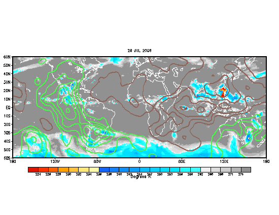
-Started archiving hemispheric WV/IR imagery and 500mb height contours/anomalies.
-Started doing Timelapse photography. Failed, but worth the attempts.
-Foreign exchange student moved in to live with us. Helped her on her first day through the Freshman orientation. Was, interesting.
-Getting a B in Honors Humanities second quarter of 07-08. Boy, that was devastating. Had to take a deep introspection afterwards about what school was about and stuff.

Friday, December 21, 2007

Prep Talk

So today, I was at our church fellowship, where our adviser gave me a one on one prep talk. It starts out with me pwning him in Connect Five, but it develops into something meaningful. I thought it was pretty cool, so I'd thought I'd paraphrase it here to the best of my ability.

My adviser starts out as always with: "Where are you in your spiritual walk?" This is always a tough question for me; personal questions are always tough cause they are always loaded with semantic traps, lol (you'll see later what I mean). But, I answer, "I could do better". Fair enough. But, obviously, this is a rather generic answer, and he sees that right away, and then proceeds to ask the question, "Are you really a Christian...Do you really trust in Jesus?"

This is where the fun part starts. He starts off with a figure. A rectangle. A foundation, rooted in God. Then, later, alongside this, he adds a different foundation. A generic church answer is well, "the world". But no. My adviser puts it blatantly: Satan. Now I get pretty surprised here. He goes on to say that materialism, worldly idolatry, greed, etc. are all products of this Satanic foundation, which contrasts with the joy, love, peace, fruit of the spirit (Galatians 5:22-23)., products of God. So he asks me, "where's your foundation?" Many people become Christians, but still have Satan as their foundation. He made an example of a disciple, who once worked with Sony, who basically gave had to move himself away, piece by piece, from this Satanic foundation.

But how to know what is the foundation? He says: look at their checkbooks. Look at how they use their time. Actions reveal character, which is rooted in either a God or Satan foundation. Does the person just use the money on him/herself or save it? Donate it to charities? And so comes the topic of decision making. He brings up this Student Leadership thing he's starting come January/February. Can't be one half Satan foundation and one half God foundation. Do or not do, it is a commitment to make. Well, I think, hmmm, this is pretty strong stuff now.

It continues. He brings up stats... and these stats are appalling. From his experience, only 50% of strong Christian junior highers remain strong in High school. Out of those who remain strong, only 25% will remain strong through college. And out of those who remain strong through college, only 10-15% will remain strong as they begin their careers. Again, the decision making process. He brings up an example of a strong Christian who, after having a baby, decided to take a break from serving God, but after a couple of years, his faith had weakened drastically. It's hard to go back up after going down. He subsequently talks about himself: his faith was wishy washy until the end of high school, but then, "by the grace of God", he changed at the end of his HS years. He remained a strong Christian, choosing his wife over other, prettier girls who were chasing him, because his wife had a strong faith.

Then he talks about the big picture. Who has the big picture? The "world" talks about planning for the future. The Christian faith looks to eternity. It's easy to make money; no need for a college education to become a millionaire. But in the end, it's all temporary. He used to watch movies every week; no longer. The pretty girls who were chasing after him; developing wrinkles and losing their figure after giving birth. The only thing that is eternal: is God. So, he asks again, who has the big picture in mind?

As always, he brings it back to how that applies to me. First thing: God created everything, so why worry about little things? Why not ask people to come to Friday night Fellowship? Second thing: what decisions am I to make? Will I be in the very large percentage of people who drop out of their faith after high school, or will I remain steadfast in what I believe in? What will be my foundation? Will I be committed to my faith? Will my faith become a Non-negotiable part of my life (i.e. regardless of how I feel or what happens, will I keep strong in my faith)? He was talking about student leaders, who say they are committed, but can't come during some weeks because "they are busy". But he himself, has all the work he does for church (talks and caring for two/three campuses of our church, CBCSD [Chinese Bible Church of San Diego]), his children, and his work, adding on to his commitment in the Student Leadership program. Who, in fact, is the busy one?

He asks again, am I really a Christian? Do I really trust in Jesus? Obviously, I couldn't answer. Those who have reached the actualization of being committed to Christ, would be able to. Three parables in the book of Matthew exist. The one he explained to me: a man goes through this piece of land, and finds a pearl. He subsequently sells all that he has to get this piece of land with the Pearl in it. Likewise, we have to give up everything we have (not literally, but more specifically our worshiping of the World), and we must trust in Jesus. [This relates to the paradigm shift found in Ephesians 4:22-24.]

Food for thought. This was a talk I believe that I needed. I've been depressed this week and all this stuff - and I've been stressing out on tests and girls too much. I need to go back down to the basics - my foundation, and go from there. This is one talk I'll need to remember in my heart, and I hope this post can serve to remind me from time to time.

Thursday, November 8, 2007

A Break from the Weather Side

It seems that I have not posted here for 2 months. A lot has gone on since then. No not anything weather-related, just personally related. So this is as much of a rant as a record, and as much as a record as a "Dear Diary" conversation (but of course, that sounds so cheesy...).

To start, I began chatting with someone who had, let's say, a bit of a hot temper. Not just any hot temper, but one that exploded with murder threats. So of course, I got all tangled up in that crap in chat, but thankfully, someone blabbed and nobody was hurt.

The bigger issue, ironically, deals with girls. Ah, the bliss of young love! Ha, well, there's this sophomore girl whom I really like. Like REALLY. Since September. Well, I just said hi to her TODAY. I suck, really, I know. Well, I assume that's a pretty good record. Yay! My first interaction with a girl I like. Then there's this OTHER girl I like, and we actually talk, since I've tutored her in chem. (PSST... she finds me funny.)

Now, tying this all together.

Morning, 1st period: I get called up to the office for something about the guy who threatened to murder. Wow, seems solemn.

Lunch: went to Chess Club for the first time. (trivial stuff just thrown in here)

3rd period, AP Bio: I see the girl I REALLY like. So basically the class was doing a lab. And when I walked to ask my teacher a question (my teacher was standing right next to her), she looked me in the eye. Wow that totally made my day! So like I was whoa there... and my cheeks started turning hot and stuff. Well this guy who sits next to me knows about this, and he's with her in 4th period, and knows her well, why this is important later. Then I see this other guy who sits next to me hold her hands! WTH???? Well, I get really pissed, but no matter. My cheeks remain red and I walk into 4th period feeling like it's 100 degrees, when in fact, outside it's bone chilly cold.

During 4th period there are some girls and myself who just like to laugh and talk, and this guy comes up, I'm like saying it's hot and stuff, and he says do you have hot flashes? This sends everyone into a laughing frenzy. lol.

Then comes the interesting part. I'm a tutor in something called AP Educational Services. Well, the guy who sits next to me in AP Bio tells me that SHE is in there. I'm like WOW, and I rush in, and yep, there she is. But behind, it's my OTHER crush! So I'm like wow wow wow 2 in 1!! I had planned that my other crush would be there, though. Still, amazing and I'm like feeling in heaven. Freaking awesome. But alas, I'm there for a reason, and it is to tutor. So I do. After I get that done, the good part begins. I start talking to my "OTHER crush", helping her with Physics. The thing is though she's asking about electrostatics which I have absolutely NO recollection of. She shows me this question involving this thing and I'm like WTH is that. She LAUGHS HER BUTTS OFF. Wow that was pretty freaking amazing, I think. Afterwards a couple of girls (one of them friends with my BIG crush) ask me over to ANOTHER ROOM to help, but guess what--I'm still thinking about my 2 crushes and dang I'm like bs'ing everything. Can't think when you like two girls and you don't know if they left. I bs it, apologize BIGTIME to them, and check back, alas, my "OTHER crush" is gone.

Not my BIG crush though. Someone has been helping her. Anyways, tutoring session is beginning to end, and I felt, hey I have some homework I could go to the school library to work on. I sorta speak that to my friend next to me loudly, and RIGHT AFTER I say that, my crush asks someone, "when does the library close"?

Yep, she wants to go to the library too. WTH.

So I go, and I can't concentrate AGAIN. There's this guy who asks me for help with AP US history, can't do it. Instead I set things up for the Hi. I help him with Bio and lead him over to where my BIG crush is sitting. I help him, and well, she's talking to someone. Not until 10 min before the school library closes is she open. She moans and groans over the homework. So I go in.

My legs are quivering. What to say?

Then I arrive. I gently say, "hey, you want some help on that?" She responds no. And then she picks up her cell phone, gets up, and walks over, then picks up her stuff and leaves.

Dang.

Now, there were SO MANY clues that she likes me as well... but the library part was just too rigged. She didn't act much like she liked me while studying in the library, in fact, it seemed as if she was waiting for the Hi. She almost NEVER asks for tutoring help. And from my observations, I could swear that she and the other guy from my table know each other well enough to be bf/gf! That leaves the question - did the guy who sits next to me set it up? Did she know already? Questions, questions. Actually I've been quite conspicuous with this crush. Most everyone I know is banking that she already knew about it. But I've been saying I would say hi for 2 months now. Why did she know it was going to be today?

So, well, that ended my adventure for today. I could've added some discriptive writing, but alas, it's too late. Maybe I'll edit this post later.

What a day. If tomorrow is as interesting I might just get the guts to ask one of the girls out.

Tuesday, September 11, 2007

The first experimental medium range SVR outlook, since, June?

Yep, it's that time again. Nearing fall.

So, as the westerlies once again migrate southward, and entangle with what remains of instability from the summer, the fall season initiates. Some years are blockbusters; other, lacklusters.

This could be the first of such an event. It's Sept... yeah, I know. Climatology doesn't favor it. But it's still worth watching. An rather large polar vortex, strong for this early in the year, is situated in Hudson Bay. Such a vortex often flattens out as the Pacific jet stream asserts itself and knocks it out. Positive height anomalies are situated in the Mongolia area attm. (ref: http://www.meteo.psu.edu/%7Egadomski/HEMI500/5dayloopjap.html )

There is actually some support for a trough over the western US in about 10 days or so. Key is the subtropical ridge. Is it strong enough to stop the trough from amplifying? Will the Pacific jet be strong enough to amplify the trough progressively, or will it cut off? Ah... so many questions and so few answers; I can feel the spirit of severe rushing back within me. Enough of excessive verbage. My point is... there is something worth watching in about 10 days for a possible severe wx threat.

Wednesday, July 25, 2007

Regarding last post

Apparently, I just realized that the velocity potential/upper divergence/MJO map I posted was from July 2006. Weird, but it's only my fault that I did not take a closer look at the datestamp discrepency.

The correct map is here:

The enhacement areas are leaving the Atlantic basin right now at an initial glance, but a new burst as appeared in the eastern Pacific. Given current satellite trends, I suspect that will intensify and move eastward. When that is leaving (maybe in about a 4 days to a week), we could see some marginal quick development. But since the Azores High is in its strongest state right now, and due to strong shearing winds in the GOM, I don't foresee any major development.

Phew! What a flip-flop.

Musings on the Atlantic Hurricane Season

Key issues in this post: possible development in the next week-two weeks; effects of the negative SST anomalies in the eastern Atlantic; hot spots for landfall activity through the remainder of the season.

So far, the Atlantic has been quiet. Not abnormally quiet as it has been in the Pacific (both the west and the east), but quiet, as usually is during this time of year. I expect this to change.

Here are the current velocity potential anomalies:


Green areas indicate enhanced divergence and increased thunderstorm activity. This area of enhancement has actually stalled the past few days, likely due to what I'll explain later in this post. In fact it was about to bipass the Atlantic until TS Dalila in the EPAC, along with a divergence from strong anticyclone in the Four Corners region, reinvigorated the ITCZ in the area. Still, the signal is rather weak, continuing to be hurt by a strong Azores High in the Atlantic, and negative SST anomalies due to the developing La Nina in the EPAC.

The question now is: will the enhanced areas of divergence enter the Atlantic. What I've noticed is that tropical cyclone development usually occurs when the enhancement areas are leaving. The Azores High tends to peak in strength in late July, so it will likely weaken from here on out. In fact, a weak trough is forecasted to amplify near the Azores, which will certainly dent the high pressure cell across the area, temporarily halting the upwelling and the SAL intrusions. When the Azores High weakens, the ITCZ will start moving northward, and perhaps by that time, the areas of enhanced divergence can get settled in the eastern Atlantic.

Don't get me wrong - the CV area doesn't look healthy - it will take time for one month of upwelling to evaporate away, even with strong sun. But that does mean, with the enhancement areas leaving the western Atlantic, we could see some development in the central or western Atlantic in about two weeks. Confidence is low, however. At this point, East coast troughiness says that Texas to Central America are the main threats if something homegrown develops, or it will come close to the east coast or recurve if something develops further east.

This discussion now brings up the second point. As of right now, the Azores High has done a number on upwelling in the eastern Atlantic. This is the first time in a long time that such negative anomalies have appeared in the MDR. Given that the Azores High does weaken like it is forecasted to, the eastern Atlantic may recover in about 2-3 weeks, which indicates possible CV development later in August. But if the Azores High remains strong, and the cold pool remains there, CV storms are not likely going to form. While the current cold pool suggests CV season might start a bit later, it is uncertain what effect, if any, it will have with the number of CV storms. If the Azores High weakens in September, and the CV storms finally come rolling, they will more likely recurve.

Which brings up the third point. Where are the biggest threats for hurricanes this year? La Nina climo argues for stronger Caribbean storms. The East Coast trough will probably remain through much of the year, if so, the East Coast would be under the gun and the Gulf Coast might get a reprieve.

For now, I would say that Mexico, Central America, Hispaniola, and Cuba are under a relatively high threat, and that Texas, Puerto Rico, and the Lesser Antilles have a moderate threat (maybe a lower threat for S. America, ABC Islands and the southernmost Lesser Antilles). All of Florida and the east coast, along with Bermuda, I would say, has a moderate threat, and the Gulf Coast has a low threat. But that's just my prediction.

Wednesday, July 4, 2007

2007 Tornado Season: A Review (FEB-JUN)

The 2007 tornado season was a fantastic one for chasers who went early. Synoptically evident event after event. Although the mesoscale often went awry (you can't predict that stuff from way out), most chasers from March-early May were treated with many good events. But then came the "Death Ridge". There were still events in late May, and June, but they were not as numerous, and often came down to the mesoscale. Of course though, my general rule of thumb is that more things will go wrong with the mesoscale, in a given length of time, than will go right. Although two events pop out in my mind, when nearly everything went right (March 28 and April 21), there were numerous other events which everything went wrong. Nevertheless, the synoptic events are listed below:

Feb. 23-24 (Early season tornadoes in TX, Lower Miss. R. Valley tornadoes)
Feb. 28 - Mar. 1 (Early season EF4 in KS, SE Enterprise, AL Tornado outbreak)
March 28 (High Plains tornado outbreak)
April 13-14 (Mainly bust, few tornadoes in TX and Atl Coastal Plain)
April 21 (TX Panhandle tornado outbreak)
April 23-24 (Plains tornadoes, mainly bust, but Eagle Pass, TX tornado included)
May 4-5 (Greensburg tornadoes, tornado outbreak)
June 6-7 (Mainly bust, few tornadoes in WI)

Chasers also caught tornadoes on March 21, May 22-23, and then June 23 in Canada. But otherwise, that was it. However, March 28, April 21, April 23-24, and May 4-5 were epic days for chasers, with many bagging multiple tornadoes, some wedges (exception of last one with Apr 23-24). For many it was a nice reprieve of the relatively boring years of 2005-2006, although certainly not legendary like 2004, 1991, 1993, 1995, 1999 et al (that I would like to correct from my previous post).

For myself, it was a new beginning. This year was the first which I had even attempted long-range severe wx forecasts. They were quite experimental, and I really did not know what to expect. And I did fairly well. Not bragging, but for my first year at attempting this, I felt like I had grabbed onto something that was right.

My high points:
-Seeing the Feb. 23 event several weeks in advance, though I was a little early with the timing
-Seeing that April would be an active month (that was true b/c the pattern was active, even though due to mesoscale factors, the tornado count was around average)
-Correctly forecasting the early June event and the subsequent arrival of the Death Ridge

My low points:
-Seeing the March 28 outbreak from several weeks out, then rescinding my prediction, only to have it happen
-Thinking early April was going to be extremely active (turns out there was a break from April 3-12)
-Not updating the blog as much as I should've

I guess my overall grade for this year's predictions would be a B+. Long-range, that is. Could've been better w/ more updates, and maybe it was luck that helped me, so an A will never be a grade until I've done this for at least 2 or 3 years.

As it is July already, my focus will now shift toward the tropics. With the tropics, I have yet to do a significant amount of research, but I will try my best.

(P.S. Since this only includes Feb thru Jun, my horrible January forecasts do not count. This is not to vindicate myself; rather, there was not enough tornadic activity in January to justify it as part of the 2007 'tornado season'.)

Friday, May 18, 2007

The second half of "tornado season" - what will it bring?

Since the outbreak of May 4-6, it has been very quiet. The major polar vortex centers have shifted toward the Atlantic and Europe, leaving positive anomalies over the U.S. and a lackluster Pacific jet. This will likely change. I have been harping on renewed activity late this month, but that is most likely not happening on a grand scale. However a disturbance from the Pacific will dive into the CONUS and provide severe chances for the northern Plains for the next few days, with marginal moisture being the major limiting factor for an otherwise nice shortwave trough.

The bigger event should come in June. As the polar vortex centers shift back into the Pacific as Indian Ocean convection is renewed, the Pacific jet should be reasserted. The subtropical jet is still in full force and there has yet to be a full fledged subtropical block, meaning the jet will have a chance to extend into the eastern Pacific and amplify a trough. Obviously, this threat should be further north, most likely encompassing the Central and/or Northern Plains. And once again, just based on the trends this year, the Midwest should not get the brunt of severe. This idea is supported by the GFS ensembles, though the European model continues to show brutal ridging reasserting itself in early June.

As the month continues, the high should strengthen and I'd expect "summer" to truly set in around mid-June. Early June activity, IMO, will be the last gasp of Tornado Season 2007, which will go down in infamy as the biggest season in the Plains in 8 years, and comparable to the infamous seasons of 1995, 1993, and 1977. The reason for this is based on trends and the fact that the Pacific jet and Alaska vortex becomes a weaker factor closer to summer, compared to the building subtropical high.

Friday, April 27, 2007

BIG UPDATE

I haven't had enough time to update this blog. But here are the major severe wx events of April:

April 3 - big severe wx outbreak with a couple of tornadoes.
April 10-11 - small event with two very impressive supercells, one over OK, one over AL.
April 13-14 - really had potential with a high risk over TX on the 13th that did not verify.
April 20-21 - tornadoes over the Plains, specifically, NE and the TX Panhandle.
April 23-24 - started out with several discrete and powerful, but widely isolated, Plains supercells. Ended with a high risk bust just to the east over I-35.

Granted, I didn't post a lot on the last two events. But as one can see, it was an active month for severe wx, although not even close to last year.

The limiting factor for this year so far has been the stagnant pattern over Western Europe and the Atlantic, which has been crunching up a fast Pacific jet. The jet is a result of Indian Ocean convection and the associated IO subtropical jet/Siberia polar jet "phasation" (is that even a word, lol?). At any rate, the flow is not as progressive when it punches into the CONUS, so basically a big bowling ball closed low results as the jet energy is forced to crunch up. These big bowling balls tend to not be prolific tornado producers. Case in point: April 24.

WHY DID APRIL 24 BUST?
For those who don't know, April 24, 2007 was predicted to be potentially one of the biggest outbreaks in the Plains in recent years. A big 500mb low was progged to hit a very moist and unstable airmass (the GFS, for instance, had predicted -10 LI's in central OK about a week out, although it did not verify). Many of the ingredients were there. Dr. Greg Forbes of TWC, Larry Cosgrove, among other very good mets were predicting an outbreak on the scale of the intensity of May 3, 1999. An almost unprecedented Day 3 Moderate risk was hoisted by the Storm Prediction Center.

In the end though, it all went bust, as convection formed too early. But why?

IMO, the reason it busted is mainly because the bowling ball closed low which had already stacked by the time. It is fairly common knowledge that a stacked low tends to be less condusive for severe wx. In this case, the dry line pushed very far east as CAA behind it intensified and the low matured and began to stack. Convergence along the dry line intensified, and coupled with strong upper air support, a line formed early and hard.

I think, that perhaps with less instability in the morning, or with some type of earlier convection to stabilize, this could've still ended up being a notable event. Strong instability fostered big anvils, which stablized things, and the convection developed into a line quickly, preventing moist inflow to areas later.

Still though, one tornadic supercell did form along the dryline later that day, a testament to how much potential this setup really had. A high risk was hoisted for central TX later that afternoon, but it mainly busted with few reports in the area. The lack of juxtaposition between the instability axis, the location of initiation, and the low level shear axis probably prevented from supercells which formed there in the afternoon, from being tornadic.

Ironically, the one strong, classic supercell that formed, formed in northern MX and entered deep south TX near Eagle Pass, TX, killing 10 people, 3 in MX, 7 in TX. It had perhaps one of the most impressive radar signatures I've ever seen, along with a monster supercell in rural northwestern KS the night before.

Saturday, April 7, 2007

Long-awaited update: 3 significant events including possibly a massive outbreak to come April 10-17

Sorry I have not updated this; been busy.

Regarding the last event in the previous blog, March 28 there was a big outbreak across the Plains. The second system failed to amplify significantly but spawned a big severe wx outbreak with minimal tornado activity on April 3.

If I had time to post, I would've said that there looked to be potential. Now it looks even more likely. Strong 150 kt Pacific Jet (PJ) is coming in. Reloading with record low temperatures across the east and snow all the way down to TX (in April!). Indeed, powerful polar vortex (PV) is right now parked over the Eastern 2/3 of the country. As the PJ moves in, it will kick the PV out, reasserting it near the North Pole. Pacific air will flood the country as several disturbances within the flow amplify over the Intermountain West.

The first threat looks to be from the 10th to the 11th. This one will be a phase of a piece of the PV and an impulse riding along the Pacific Jet. Right now, a lead disturbance that goes through in the morning is the question mark. Will it be weak enough to not cause too much an effect for the bigger stuff in the afternoon? Nevertheless, given my analysis of previous events, the fact that moisture might be limited will not allow this to be a historic outbreak, IMO.

Next threat: 13th thru 15th. This one could be the biggest depending on the third system (see belwo). Another disturbance will come in via the Pacific Jet Highway. This time there could be more moisture to work with. Details are sketchy right now, since it's a week away, but dynamics look incredible (just as they will for the first system), but there will be more moisture to work with - latest GFS paints 65° to 70°F dewpoints all the way north to Memphis, TN. Caveat may be if the first system doesn't move out quickly enough.

Final threat before I think things calm down again: 15th thru 18th. This one is a question mark. The full force of the PJ rolls in this time, so this certainly has the most potential with regards to dynamics. But the instability is the question mark. It looks like this might be the signal of another pattern change as the Pacific becomes extremely convoluted after this and the NAO tanks. In other words, another cold pattern for the east. (BTW, do want to remind everyone that the idea of the "reloading pattern" with the PV over Hudson Bay -- only works consistently for early season and cold season outbreaks. Not going to go further into that though). If the NAO tanks early, this system will not have moisture to work with as the second system gets caught up and trapped behind the building ridge/block. If the NAO does not tank early, or more specifically, the second system moves out of the way, this might be the biggest of the three events as it will have the full mass of the PJ helping it to amplify into a low-amplitude high-wavelength trough -- most ideal for big outbreaks. Won't get into too much detail here as well.

Most of the major global models that go to the 240 hr range - specifically the GFS, CMC, and EURO, show the progression of these three systems. So confidence is much higher than last time where I had the right idea initially but bombed it due to relying too much on the poor model performance.

Thursday, March 22, 2007

Update; multiple threats at end of month and perhaps early April

The severe threat for this week does not seem significant to me, cutoff lows usually do not do much in the way of severe. I do not think there is any major event regarding the cutoff.

A lot of things look up for major events (perhaps four), coming up in the next two-three weeks. First of all is the one that I sorta called off twice. Way back about 1-2 weeks ago, I had predicted an event around this time period (did not write it on the blog). Then I "cancelled" the event after models had consistently predicted no such event would happen for several days. Shortly after that, the models caught on (goes to show that it's perhaps better to go with observations and extrapolation than pure models in the long range). But I had doubts on whether it would cut off, and believing that it would, in my last post I had written that it might.

That idea looks to be wrong. A strong Pacific jet will prevent that from happening this time. The 500mb hemispheric pattern looks pretty ideal, in fact. In many outbreaks, there was a cutoff or a closed low over the SW that gave way to a strong jet stream which drove a larger, more mobile longwave trough that ended up being a big event. The reloading period had already been done a few days ago. Right now, the key continues to be the ridging over the CONUS.

Revision: the posts I had...
http://www.easternuswx.com/bb/index.php?s=&showtopic=128581&view=findpost&p=1831884
http://www.easternuswx.com/bb/index.php?s=&showtopic=128581&view=findpost&p=1832127
http://www.easternuswx.com/bb/index.php?s=&showtopic=128581&view=findpost&p=1833459

There are two disturbances that the renouned polar vortex over Alaska (key forsynoptic severe outbreaks) are going to spit out. One initially will amplify pretty far west according to models. The problem with this one is because it amplifys over the EPAC instead of the Intermountain West, it will likely become very high amplitude once it approaches the Plains, and thus, shear vectors will be unidirectional. Another potential problem is regarding moisture return, since models do predict a closed low over the Bermuda area which could lead to a high pressure cell too far north to tap into a Caribbean moisture source. Although I believe the models are underdoing the moisture return, most of the biggest outbreaks do not have that feature and instead have a semizonal, maybe slightly purturbed, flow.

The second disturbance is the question mark. If this trough materializes, it has a lot of potential. This one should have a source region closer to Alaska as the polar vortex splits, and one piece flies into Siberia. The question mark for this is indeed how the first trough moves away, and how strong a ridge is left behind over the southern CONUS. Will it amplify? If the first trough does not move away quickly enough, will there be enough return flow and instability? All those questions should be resolved within the coming days. FWIW, the Euro has been questioning the validity of the possibility of this, being incredibly pessimistic. So obviously, I'd trust the better model for now. Analysis, extrapolation, and pattern recognition suggests that in a case like this, the more widespread severe wx the first produces, the less the second produces. So really, I don't know which is bigger, except that I'd expect a least one significant severe wx outbreak with these two threats.

As the other piece of the PV moves into Siberia, the pattern will reload. A ridge will redevelop over the Aleutians, but it will be short-lived as the reformed polar vortex over Siberia reinvigorates the Pacific jet, which will most likely undercut the Aleutians ridge yet again. This new piece could lead to another big event in early April.

Stay tuned.

Sunday, March 18, 2007

Major update - Multiple threats coming at the turn of the month possible

OK yeah I wrote two days ago that I did not expect any major outbreaks in March. I will change that because the timing of the "big tamale" may be earlier than expected.

Note that the latest European has a significant system around the 240 hr range, and so did the 18Z GFS. I am divided on the threat will not materialize like what is depicted on those runs, because the fundamental pattern really is sorta tricky. Sure, we just had the reloading with the sleet storm over the NE, and that piece will reinforce the Hudson Bay PV, but the big problem is the flat ridge over the CONUS. When does this go away is the question? We've had the Aleutian blocking high now eroded. As the next system dives down into the CONUS, the energy over the EPAC will split, sending the next system into Mexico where it will cut off (still a severe threat around the 21st but not too big given that cutoffs usually don't produce a lot of severe). The other piece will deflect northward and form a very strong and deep polar vortex (PV) over Alaska. This is where it gets interesting.

As this happens, a massive block develops over Scandanavia (yes, another block, as I said blocks don't go away easily). Some ensemble members are progging closed 576 contours at 500mb over northern Scandanavia (keep in mind, this is March and that's near the Arctic circle!). So this pattern becomes pretty stagnant, with the PV on the Alaska and Russia side, and the block in northern Europe, and flat zonal flow pretty much everywhere except invof the block. So now the question is, how powerful does this block become? If it becomes so strong that there's cross polar flow, the PV over Alaska becomes essentially trapped. OTOH, if the block slowly breaks down, this will allow the PV energy to branch off. The timing of the PV branching off is indeed the timing of what I think could be an extremely active period. This, according to the GFS Ensemble mean, should occur ~228 hr.

However, as the PV branches off and leaves a small portion over the GOA to amplify into the next longwave over the western CONUS, what happens to the flat zonal ridge over the CONUS? This is why I am divided on the initial threat. If that ridge is too powerful, the low cuts off again. BUT, many of the biggest outbreaks occur after a cutoff over the SW is ejected out. The reason is that following pieces of energy start out more progressive and less amplified in the EPAC and thus don't have as much tendency to cut off after amplifying over the West (in fact, just take a look at Palm Sunday 1965 for an example of this, the pattern was very much in support of cutoffs, the the shortwave that spawned the outbreak just barely missed being cut off over the SW, even though the part that it split from did indeed cut off).

The next few disturbances after that are uncertain, but let me just say this: ANY disturbance which manages to stay progressive (the chances will be enhanced if we have semizonal Pacific jet with small kinks in it) will have the potential to be significant severe producers. This is going well after 240 hr, and will most likely feature big events from March 29-April 10. The caveat for multiple threats is if the first disturbance manages to really amplify and form into a new PV, which will shut down the pipeline.

Note that an alternative option would be for the big event to occur at ~240 hr, but although the mainstream models seem to show it, it seems like the less likely option right now.

All of this is subject to much change, of course, as this pattern's pretty dynamic and unpredictable.

Friday, March 16, 2007

ok yeah I do apologize for not updating this

There was a big tornado outbreak on Mar. 1. Moisture was good and the dynamics were more than sufficient with the only thing preventing a bigger tornado outbreak was the convection to the south which resulted in a more concentrated tornado outbreak rather than a larger more spread out one, and also, the separation of the better low-level kinematic fields from the better instability in the north.

The pattern since then has been docile. Large flat zonal ridge over the U.S. Because of that, I do not believe there will be any MAJOR severe wx outbreaks for the rest of March. REVISION 11:49 AM PDT Mar 16... the 12Z GFS is particularly ominous for an outbreak in about a week. This one is a tough one to forecast since there could be a potential for the disturbance to cut off at a very early stage of the game, which will cut down the severe chances. Right now am leaning on a minor severe wx event, and go more bullish as time goes by if it warrants. The overall synoptic scale looks pretty good actually with an ejection of a trough over the NE giving way to the Pacific jet. So of course it deserves watch...I may have overlooked it yesterday night when I posted this entry.

I think the next big severe wx event(s) will come when we get the next major "reloading period", the time when we get some time of sufficiently long lasting cold intrusion. The current pattern is downright terrible for any type of severe wx, if this was in May or June, and could in fact be one of those severe season enders since cool snaps are pretty difficult to get in June. So definitely, better now than later. Research from some renouned long-range experts do suggest that the NAO would switch to negative sometime in April. The long range progs also suggest that the Pacific jet should be somewhat above normal in terms of strength. In this case, the PJ is NOT GOOD if it keeps things zonal. We're gonna need some type of minor amplification, outside of the major amplification, the block over the Aleutians that's causing the backup and resultant stale pattern.

I still think a big outbreak is very possible during April, especially early April (in fact, with the polar vortex over the Pole and dropping energies down, along with a fairly zonal Pacific, prelim indications are this could be significant -- if it materializes). Looking at the really long range, right now it seems the Aleutian block could remain for reappear frequently given the tropical influences (the Nina). Since wavelengths do shorten in the summer, what effects that could have is still uncertain to me right now.

Wednesday, February 21, 2007

Long-awaited update

I don't know of any visitors who aren't from weather forums, but for those who are, usually when the event comes near I'll post my thoughts in forums rather than on my blog, and then compile them following the outbreak. If there is anybody who actually reads this for pleasure, I can point to where I am posting them, but I will only do that if someone posts a comment saying they know of no weather forums.

With that said, the threat seems to be somewhat lessened by a strong longwave trough which has appeared on the progs, near Newfoundland. Just to the west of the ideal. Thus wavelengths, and resulting moisture and instability, will be limited, due to recycled cP air.

Saturday, February 17, 2007

First call...Major Outbreak could be on tap

The GFS and Euro now concur: the potential exists for a major outbreak. All the parameters are there. Lower than normal SLP's, strong LLJ, good thermodynamic environment, etc.

Don't think I have much to say anymore, so here's my First Call:


P.S. the threat on the 21st doesn't seems so impressive now as the wave looks like it flattens out after leaving southern California.

Wednesday, February 14, 2007

Refined threat dates. Has some serious potential IMO.

First of all, I do apologize that the model pic in the last post is outdated. I did not know that even after uploading an image to Blogspot, the image is still active and auto-updating.

A note on the last system -- 1 person was killed in New Orleans, LA as a result of a nocturnal tornado. I pretty much busted on the last system as I didn't anticipate that nocturnal event, which was probably a result of localized enhanced low level shear from the warm front.

OK, onto next week.

As the polar vortex in the northeast begins to retreat, the flow over the CONUS begins to turn more zonal. One thing to keep note is that the ridge over the western CONUS has not been a true block, so to speak, so it is undercut quite nicely (this is unlike Jan. 2003, when the ridge was an Omega block that persisted for entire January, preventing any sort of severe wx). SST's and the ENSO support mild Pacific air beginning to infiltrate the CONUS next week as the Pacific jet stream is allowed to impact the CONUS unobstructed. Thus, the flow begins to turn zonal.

(Note that several significant outbreaks have occurred after this scenario occurred. Several I can think off the top of my head:
4/3/1974
3/13/1990
1/21/1999
3/12/2006
11/10/2002

I suspect that the remains of the cool air allowed for steeper lapse rates than what would be expected, and also, the atmosphere is in a constant state of balance, something I explained when I started the thread on Eastern two weeks before the 11/14-16 tornado outbreak in 2006.

There are other times where it did not occur, but I have explained that in my previous paragraph before the parentheses using Jan 2003 as an example.)

Disturbances will ride along the jet stream. A slight ridge will still remain, which the initial disturbance will cut through. This disturbance could spark the first of possibly two severe wx events. Timeframe: Feb. 20-22. Threat should not be too significant although a localized outbreak is possible. This was the system that I harped on a week ago. However, this is not the big tamale, so to speak.

The first disturbance will leave a perturbation in the flow as the weak ridge retrogrades to the Aleutians. This leads to a trough downstream. All the ingredients come together for a vort lobe or a shortwave to accelerate down the eastern side of the ridge, carving out another trough over the Intermountain west. This is the second system. Timeframe: Feb. 23-26. This could be significant. Since the image I posted, each GFS operational and ensembles run have showed 1) trough digging in the intermountain west and tugging eastward, and 2) a sub-1000 low. Incredible model consistency, and stuff that really deserves watching. How fast the first system goes away will be critical in determining how much return flow will be available for this system. If sufficient, this really has a LOT of potential to be a significant severe wx outbreak from the Plains to the foot of the Appalachians, and from the Gulf Coast all the way up to the Great Lakes.

Basically, after that, I believe there are two options:
1) If the Feb. 23-26 system turns out to be large amplitude and wide, it could merge with the remnants of the Polar Vortex over Canada and draw another shot of cold air over the eastern CONUS, ending the severe wx threat.
2) If the AO (Arctic Oscillation) does not remain negative, zonal flow should begin to dominate; there will be no sufficient Polar Vortex over Canada.
3) The Pacifc could reload, resulting in another outbreak.

In reality, I believe the first option is the most likely at this time to start out March. Looking out REALLY long range, another high-impact event is possible in mid-late March if Scenario 1 verifies. If Scenario 2 or 3 verifies, any additional severe wx events should be relatively localized and small until later in spring (possibly waiting until late April or May).

Anyhow, some other pros' comments:

DVD on EasternUSWx:
And now, on to the next one.....give it 7-14 days and I think the severe weather crew will be very busy. Just a sneak preview there of what I'm preliminarily beginning to think.

Hoosier4caster on EasternUSWx:
I reappear just to be the bearer of bad news...All sign's pointing to the end of winter for much if not all of the E Conus after the period of 19th to 22nd. Indices have been hinting at this for days...with model representation of the upcoming pattern change. So start gearing up for Svr weather season...its right around the corner! There maybe a brief shot of colder air...but nothing like what we have seen the last few weeks. And no I don't think we are heading for 60s either, just normal to slightly above...as the pattern change is at hand.


Now, the following are images from the Op GFS since the Feb.12, 12Z run, to prove its consistency. You'll have to trust me on the Ensembles, they have been agreeing well.

12Z Feb 12 run:


0Z Feb. 13 run:


12Z Feb. 13 run:


0Z Feb. 14 run:


I hope you get the point. This does not even include today's runs which continue to show this.
After 5 or 6 primary runs that have good support from the Euro and the Ensembles, I think it's a good betting hand.

Sunday, February 11, 2007

Update on tomorrow's storm and LR

Tomorrow's storm may be limited by the Gulf action I pointed out yesterday. Once again, SLGT risk looks to prevail. I am concerned the warm front may still lift farther north than expected, and one cannot discount the underestimation of instability that the models have struggled with throughout the winter. So tomorrow's threat is still there despite a more benign look on the 0Z models. I'm not really interested in it though, so I'll skip the details that I planted yesterday.

EDIT (italicized portion): Never mind, I will do some analysis. The latest SPC SWODY1 has peaked my interest.
Right now the dewpoints are meager at best, however. The LLJ is not strong at all - the best dynamics are still far out to the west in western portions of TX. I saw that they wrote of a dynamics driven event, again, I just do not think that is true. However, I am torn.

First of all, moisture transport looks to be not very rapid until 12Z tomorrow. The warm front is still offshore of Houston right now. With that said, by that time, the LLJ could indeed finally start picking up. Either it picks up later and this becomes a nocturnal concern, or it picks up earlier and we get an event from 18Z-3Z. Both options are quite viable, and due to the stability right now, there is concern that the models could underdo the 850mb LLJ. The system in the GOM is already halfway through. One more thing - sats do indicate a possible N-S oriented long outflow boundary left behind in the western Gulf. That could become a significant factor in focusing "junk" convection, or "good" convection (if it lifts north).

Now, the speed shear isn't that great. And there could still be a mini cool front left over in the Yucatan Channel. So, pretty much, it's going to be all dependent on mesoscale features. Boom or bust, I say. When it's dependant on mesoscale features, 9 times out of 10 it will underperform.

The last thing that leads me to err on the side of caution: 10% nonhatched tornado probs at 6Z SWODY1 has never verified.

--------------------------------------------------------------

Onto the next event, which I will revise my outlook. There are two systems IMO, the first of which seem to be well-modeled on the ECMWF and its ensembles. GFS, I really would not agree as it has been overly trigger happy with cutting off lows the past few days. The second system IMO will be the bigger one. I think that following the second one, a break will arrive in terms of severe.

Approximate dates:
First system...18th thru 20th
Second system...22th thru 26th

I am a bit concerned as the timeframe has been trending later and later, so more than likely, the events may materialize during the latter parts of the timeframes given.

Pattern recognition continues to support major potential. Several things I look for:
1) Polar Vortex breaking down, western ridge undercut, zonal flow
2) Support of amplification of a ridge in the Aleutians vicinity in order to induce a trough digging in the west.
3) An earlier shortwave which allows a slight trough to take hold in the west, which allows the next disturbance to dig more and possibly become negatively tilted.
4) When the time comes, a zonal flow across the Atlantic with slight perturbated shortwave just east of Newfoundland (teleconnects to pos. height anomalies along the east coast)

Note that one more thing, the Nino is switching to a Nina at this time. Indications are that the Nina is going to be strong, as the PDO values were never really strongly positive. That means that the Nino, didn't really act like a Nino. Similar to the 72-73 strong Nino, which was followed by the strongest Nina on record. What does that have to do with this? A Nina favors amplification in the Aleutians vicinity and favors a -PNA. This may be a part of that overall change.

Many of the signals are there. The ensemble mean has been fairly consistent with the following solution.
Starts out with polar vortex reasserting itself after the Eastern snowstorm. That lifts out and the NAO switches to negative.
Pacific energy begins to undercut what is now a very negative AO styled high latitude block. Eventually, some energy makes it to the Pacific NW, but cuts off.
One shortwave does make it through and picks up the cutoff, flinging it east. This produces storm #1.
Second wave comes thru and digs deeply in the wake of storm #1. If this materializes as expected (and I do believe it will), this is the bigger storm.

Now, this is still 2 weeks away granted, but the potential is there. Here's what some pro mets are offering.

Mr. Ed Berry:

At this time most of the CONUS has below normal temperatures with an active storm track from California into the eastern states. During weeks 2-3 I would expect all of this to slowly shift northwest meaning by late this month an active southwest flow storm track across from the Rockies into the Plains would be probable. Cold and moist energetic troughs would be expected to dig into the western and central Rockies and then lift northeast into the Mid/Upper Mississippi Valley. Given the South Pacific signal (and we need to monitor the east Pacific where there are still warm SSTs – at least for now remembering the cold subsurface), a moist subtropical jet with closed lows may interact with this storm track (GSDM 4-1 instead of Stage 1). While late winter storms would occur in the cold sectors, heavy rain and severe storms would be probable for much of the Deep South into the eastern states. In general, this would be an active pattern for much of the lower 48 states. There would be cold to the northwest and warmth for the far southeast. Alaska may stay under the ridge while closed lows may develop near/west of Hawaii. Finally, with variations in amplitude, I could see this type of pattern persisting well into spring.


Mr. Brian Lovern:

One other thing I will throw out, and I'm glad it was brought up earlier, is that this pattern, should it hold into spring, is classic for severe weather. I won't be shocked to see one more cold period in early March after the late February milder turn, but then we should see things flip after that IMO. I also agree with you that a nino is typically not a SE ridge promoter. A nina, all other things equal, is much better for this.


One final note - 0Z OP GFS run shows a massive severe wx outbreak on the 24th. It's the OP GFS, but does support the idea of a severe wx outbreak that I've been harping on for 5 days now.


Saturday, February 10, 2007

Switching gears temporarily...

All along, I have been focusing on the threat from Feb. 17-24. I still believe the threat is there even though the models have been shying away from it. Except the Euro, now that it has entered its range.

Now, let's talk about the threat on Monday. Since two posts ago, I've been harping on the threat being minimal. Maybe doubting that call a bit. A few trends on the models have piqued my interest.

1) A small disturbance in the GOM that halts moisture transport on the eastern GOM. It is visible in water vapor imagery. This could become an issue, although I believe GFS may be suffering convective feedback and overdoing it a bit.

2) Strong dynamics, stronger mid level winds and stronger 850 LLJ. This is BIG and weakens the argument of deep layer shear being a problem. HOWEVER, winds in the upper levels are still lacking per the GFS, although not on the NAM. Now is the time where the NAM begins to shine, and this will again be straightened out over the next day.

3) Arctic High is now further north, with the bulk of it over Canada. This could shift southward though again - it is all up to the Polar Vortex over northeast Canada (which the easterners are discussing with regards to a possible snowstorm on Tuesday). But this is a big change from the oppressive arctic high in southern Canada, ready to dive into the Dakotas, that the models were showing a few days ago.

This will NOT be a dynamics driven event - if anything, given climo, the dynamics are lacking and the instability should not be a problem. The forecast soundings are showing minimal instability. I disagree. There's a 40 kt LLJ extending from the Yucatan, and no way are dewpoints merely in the upper 50's (per NAM). Considering 500T's are less than -15°C, that's a signal that instability will perhaps reach 1500 J/kg, perhaps even more if some sunshine comes out (and given the lack of strong forcing and cool mid level temps, along with hints of mid level drying on fcst soundings, that seems likely). Yes, the models show less than ideal temperatures at the surface, but they often underdo WAA. So, with that said, instability I think is there. However, this is only assuming that the arctic high remains up very far north, and the disturbance down in the GOM does not interfere with moisture transport from the Caribbean.

Just given the uncertainties, and the lack of speed shear, a SLGT remains the best call for now. However, with a bit more dynamics and a stronger surface low, I'd go moderate, but there's too many uncertainties for now.

With that said, here's my first call for Febrary 12-13. The threat on the 12th is mainly west of AL, 13th to the east.


Note: See Text - as the primary low occludes and the secondary coastal low (which leads to the snowstorm) forms, the severe threat should diminish. Still, enough instability should remain over Florida for a marginal threat.

Wednesday, February 7, 2007

Confidence increased, details in post

The chances of a severe wx outbreak affecting the CONUS has been raised to 25%, give or take. The GFS and its ensembles are really latching onto this idea of a strong Pacific jet stream carving out a trough over the intermountain west. A LOT can still go wrong, and these are still thoughts, not a true forecast.

Just wanted to add something regarding overall teleconnection patterns, although I'm really not good at them though. First of all, the SST's over near Japan are above normal. The temperature gradient between the Bering Sea and the central north Pacific is greater than usual (negative sea sfc temp anomalies over the Bering Sea and positive over areas further south). Negative anomalies are still strong over the Gulf of Alaska. These signs suggest that a stronger Pacific jet stream is favored. In addition, my current research indicates big but brief spurts of tornado activity are favored as an El Nino weakens. Otherwise an El Nino favors a quiet tornado season. As this current el nino weakens, this outbreak goes along with Nino climo.

As of right now, my preliminary call is for an event from Feb. 17-24. Many big events have happened on the 21st before, but that is just pure coincidence. Could this be a repeat?

SSTA's:


12Z operational GFS (BTW, it's extremely dumb to use post 300-hr GFS unless the pattern and the ensembles support what it shows. This is mainly just for future verification.)


I am in the process of attaching the ensembles.

EDIT 2-14-07: For those who read this blog (how many?), I apologize for not attaching the ensembles. I've had it on my hard disk, so here it is:
Click to animate


One last thing - I feel a SLGT risk could still verify for the Day 4-5 event, but again, the arctic high to the north is not a recipe for a major outbreak.

Tuesday, February 6, 2007

More thoughts for the next few weeks

Last post verified in terms of intensity with a significant outbreak in central Florida which killed 20 people and attracted national news. However, the warm front did not far as north as I expected, which led to a personal bust in location.

Onto the next event which the SPC already has outlined for a risk.
http://www.spc.noaa.gov/products/exper/day4-8/

However, I believe the talk of the event will eventually just be that, talk with no verification. Taking the GFS verbatim, yes it screams major severe wx outbreak. But the GFS isn't too good in terms of verification. Major problem: 1) speed shear which often is associated with strong winter tornadoes is lacking, and 2) strong arctic sfc high across the eastern U.S. The OP GFS does not show this, but the European and the ensembles do. The second issue is by far the bigger one, and IMO will keep this from being a significant event except for fish. Given that the OP GFS has a bias of underdoing cold and warm air advection (specifically in this case CAA associated with an Arctic High that the GFS seems to be underdoing), it can be thrown out.

Of bigger concern for me is a possible event following the one mentioned above. Another shortwave will dive into the CONUS but IMO that will also be moisture starved. It is a possible event after that that is of concern to me. The signals are weak, but after contemplating this for a few weeks, I decided to post my thinking here. Won't go into detail but it seems big events happen after cold outbreaks. But there are a few conditions: first of all, the polar vortex over Hudson Bay has to move out for good. That in itself will be hard to achieve if the Arctic Oscillation (AO) does not rise back to neutral or positive. The ensembles are divided. I'm still researching on synoptic conditions that lead to synoptically-evident setups but there seems to be a subtle correlation.

Up until last weekend, the correlation was weak enough and the ensembles pessimistic enough so that I pretty much forgot about it. Originally I was thinking Feb 10-17 to be the timeframe. I'm going to move that down a week. Again, it's a mere possibility, and the mesoscale is always the key. However, the ensembles seem to be going more gung-ho around the 240-348 hr (yes, very far out!), and if there a synoptic setup in February that is clearly classic enough to support some big fireworks, this in my opinion is it. Longwave in western CONUS, longwave east of Newfoundland, and below normal SLP's across the CONUS are the general signs for synoptically evident event in the cool season months.

One final note - "El Nino rains" may finally begin for SoCal late this weekend after an excruciatingly dry rainy season so far. I'm not paying too much attention to that for now. Possible snowstorm for the NE next week as well.

Monday, January 29, 2007

February Could Start Like a Lion for Parts of the Southeastern U.S.

OK, so I go to the SPC page as I'm sorta bored. Then I see a risk area on the experimental 4-8 day outlook.
http://www.spc.noaa.gov/products/exper/day4-8/

OK, all right, all right, I look at the GFS.

I fall out of my chair.

Downright scary setup... downright scary.

90 kt at 500mb, 60-70 kt LLJ, lack of strong arctic highs, strong southerly flow from the Caribbean. What more can I say? This has the potential to be a significant tornado outbreak for areas of southeastern AL, southern GA, and the FL Panhandle. Truly amazing setup. The question mark is instability and lapse rates, as always. However, given that the last few days have been fairly cold for the east, lapse rates could be slightly steeper than progged. Right now, I don't see much of a reason to downplay this thread except for the aforementioned condition, along with possible contamination of the warm sector by earlier convection. Of course, that is a big if, and a big reason for someone to downplay this. Nevertheless, I've seen many outbreak days the past year where the convection did not harm things as much as expected. The warm sector should be expansive, aided by strong southerly flow across the GOM. IF the lapse rates can steepen some more, I expect a loosely organized squall line along the front with supercellular activity ahead of it. IF the low strengthens more quickly than progged, a derecho could be possible, although this option seems quite unlikely to me.

I'll provide images when I get the chance later tonight or tomorrow morning.

Sunday, January 21, 2007

8 short years ago today, an intense pacific jet carved a deep progressive longwave trough over the High Plains

...following a sharp arctic blast across the midwest characterized by sub 490 dm heights over the Hudson Bay. The Pacific jet reached its full fury when the western ridge crashed, followed by the retreat of the PV over Hudson Bay. At H5, the jet streak reached speeds of over 110 kt as it crashed ashore in California. With very little impedement in the form of a SE ridge or a substantial PV over Hudson Bay anymore, a large low-amplitude longwave trough was carved, and with several days of moderation along with a strong surface low pressure, moisture streamed in. Strong speed and directional shear provided an adequate environment for strong, long track supercells capable of producing significant to violent tornadoes. SPC issued a High Risk for January 21, 1999, at 6Z.

Thanks to the SPC High Risk archive...

CONVECTIVE OUTLOOK...REF AFOS NMCGPH94O.

VALID 211200Z - 221200Z

THERE IS A HIGH RISK OF SVR TSTMS THIS AFTERNOON AND EVENING OVER
PARTS OF CENTRAL/EASTERN AR...NORTHEAST LA...NORTHERN MS...AND
WESTERN TN...TO THE RIGHT OF A LINE FROM ARG DYR 30 WNW MSL CBM 45
NE JAN MLU HOT ARG.

THERE IS A SLGT RISK OF SVR TSTMS TO THE RIGHT OF A LINE FROM GLS
GGG PGO HRO MDH OWB BNA BHM MOB.

GEN TSTMS ARE FCST TO THE RIGHT OF A LINE FROM 45 E PSX TYR MKO SZL
PIA MIE CRW PSK SPA ATL PNS.

GEN TSTMS ARE FCST TO THE RIGHT OF A LINE FROM 30 WSW P28 CSM TCC
LVS ALS COS GCK 30 WSW P28.

STRONG UPPER JET MAX CURRENTLY OVER THE WESTERN STATES IS FORECAST
TO MOVE SOUTHEASTWARD INTO THE SOUTHERN ROCKIES BY THIS
AFTERNOON...WITH LARGE UPPER TROUGH RAPIDLY AMPLIFYING OVER THE
PLAINS. NOSE OF STRONG MID LEVEL WINDS WILL SPREAD INTO CENTRAL TX
BY 00Z...WITH SURFACE LOW DEEPENING OVER OK. SURFACE DRYLINE WILL
EXTEND SOUTHWARD ACROSS EAST TX...WITH WARM/HUMID AIRMASS ALREADY
IN PLACE TO THE EAST.

ISOLATED STRONG/SEVERE THUNDERSTORMS MAY BE ONGOING AT THE
BEGINNING OF THE PERIOD OVER SOUTHERN IL/WESTERN KY...WITH LARGE
HAIL BEING THE MAIN THREAT. THESE STORMS SHOULD SPREAD EASTWARD
ACROSS THE OH VALLEY DURING THE DAY IN REGION OF MODERATELY STRONG
WARM ADVECTION. HOWEVER...WEAKENING INSTABILITY WILL LIMIT
EASTWARD EXTENT OF SEVERE THREAT.

AIRMASS ALONG AND EAST OF DRYLINE OVER AR/LA WILL BE MODERATELY
UNSTABLE BY MID AFTERNOON WITH SURFACE-BASED CAPE VALUES OF 1500-
2000 J/KG. ISOLATED THUNDERSTORMS ARE EXPECTED TO DEVELOP IN THIS
AREA AND SPREAD RAPIDLY EAST-NORTHEASTWARD ACROSS WESTERN
TN/NORTHERN MS DURING THE EVENING. MODEL FORECAST SOUNDINGS SHOW
VERY STEEP MID LEVEL LAPSE RATES AND DRY AIR ALOFT...FAVORABLE FOR
LARGE HAIL AND DAMAGING WINDS. ALSO...STORM-RELATIVE HELICITY
/300-500 M2/S2/...MAGNITUDE OF DEEP LAYER SHEAR /SFC-6KM SHEAR OF
45-55 KNOTS/...AND STRENGTH OF MID LEVEL STORM-RELATIVE WINDS /20-
30 KNOTS/ INDICATE POTENTIAL FOR A FEW TORNADIC SUPERCELLS ACROSS
THE HIGH RISK AREA. GIVEN THE STRENGTH OF FORECAST SHEAR
MAGNITUDES AND THERMODYNAMIC PROFILES...ISOLATED SIGNIFICANT
TORNADOES ARE POSSIBLE TODAY OVER PARTS OF SOUTHEAST AR...NORTHEAST
LA...SOUTHWEST TN...AND NORTHERN AL.

ACTIVITY WILL LIKELY PERSIST THROUGHOUT THE NIGHT...SPREADING INTO
PORTIONS OF MIDDLE TN AND AL BY 22/12Z. DAMAGING WINDS AND HAIL
SHOULD BE THE MAIN THREAT BY THAT TIME.

..HART.. 01/21/99


Nobody would've ever fathomed of the destruction that would follow. 84 tornadoes touched down on that fateful day, including 24 significant tornadoes and 10 tornadoes of F3 intensity or greater. Several counties in central AR were pummeled again and again by training tornadic supercells.

Image courtesy of JKTinMemphis:

http://www.easternuswx.com/bb/uploads/post-1877-1151183686.png

"Classic" string of pearls look, never before seen in January. It was by far the most powerful tornado outbreak in January ever, following the outbreak of January 17.

In all, 8 people were killed and hundreds injured in what would be the biggest January outbreak ever.

-----------------------------------------------------------------------------------------------

500mb plots, geopotential height and wind speeds:

0Z Jan 21

http://img66.imageshack.us/img66/8075/1999012100z2zj.png


0Z Jan 22

http://img66.imageshack.us/img66/3277/1999012200z2tw.png

Saturday, January 20, 2007

How do I title this post... Vent I guess?

I've survived two finals and made it out alive...AP Euro and AP Calc. A in both classes, thank goodness. I'm really scared about the other two which are my hardest classes. Hon. Humanities and AP Chem. Biggest worry being the first one, since there aren't any AP tests to cover for it.

It's interesting to reflect upon the warnings my now junior year friends told me about the Humanities class. "Don't take it...it'll drop your GPA, don't get on [teacher name]'s nerves" etc. Really it's interesting how things would've been different had I not been forced to choose my classes in a 5-min time frame (it was due on a certain day and they forced us to choose 5 days before that day. I did not know and neither did anyone else). I probably would not have picked AP Euro, and replaced it with Orchestra, but just maybe I would've had time to do a better job on the Thesis paper.

Well anyway, as I stare at my screen, I realize that whatever has happened has happened. In middle school, getting straight A's was for my parents. In 9th grade, getting straight A's was for myself; I had changed. Now, I don't know what to think. I'm starting to go back to "I must get straight A's for parents" again. I really don't know what to say. My grandparents always had a lot of hope for me. To work until 2 AM nightly, and to have them know, only to get a B as the result, is undoubtedly heartbreaking for them. For my parents too. For me, I'm used to sleeping 6 hr per night and marginally passing.

I've always been very lucky. 90% in Orchestra 1st quarter of High School, after bombing playing tests. 90.3% in AP Chem 1st quarter of Sophomore year, after bombing the midterm. Countless times in previous English classes to have a C at the end of 1st quarter, and bounce back after stressing out. English has always been my weak spot, and always will be; as my first language was not English. I've always trended toward being brief and terse, and this is probably my longest post ever.

Now, as I stare down the possibility of getting a B in Humanities, I feel like giving up. Note that Thursday night at approximately 1 AM, I made a thread about giving up, but then I deleted it. (Tom may have seen it but there were only a couple of views other than my own.) There was reason to delete it as I'm sure people would've flamed me, and with good reason: whining is for jerks. We all do at some time but to do it on an open message board is downright naive and sinful.* Hopefully, I've tried to remove any traces that I'm complaining/whining in this post, although part of my intention is to vent, since I have no other human contact outside of message boards. It is time to accept reality and destiny, and getting a B is a part of that. Life's tough but it will go on. Perhaps this newfound attitude is the result of an intensification of my faith in God, one area which I feel like is necessary to improve on. Worrying has always been a big part of my sinful nature.

Thanks for reading, whoever read this. I'm sorry if I wasted your time, I tried to make this read as interesting as possible for whoever was going to finish it. I'll post it in my blog as well. I hope you don't hate me because of this.

*Note: Paragraph before last one, ignore part bolded.

Sunday, January 14, 2007

Extreme cold in SoCal

Bitter cold here. Bitter cold...for our standards of course. Haven't been this cold in some time. In fact, there was snow yesterday.

NWS San Diego Pub Info Statement on cold temps

PUBLIC INFORMATION STATEMENT
NATIONAL WEATHER SERVICE SAN DIEGO CA
1100 AM PST SUN JAN 14 2007


...OBSERVED MINIMUM TEMPERATURES AROUND THE REGION FOR THIS MORNING...

LOCATION OBSERVED MINIMUM TEMPERATURE

SAN BERNARDINO COUNTY

FAWNSKIN RAWS.................. 0
BIG BEAR LAKE.................. 3
WRIGHTWOOD..................... 4
HESPERIA....................... 6
EL MIRAGE RAWS................. 6
APPLE VALLEY................... 8
LAKE ARROWHEAD................. 9
VICTORVILLE....................12
MORMON ROCK RAWS...............13
MEANS LAKE RAWS................14
ANGELUS OAKS...................16
TWENTYNINE PALMS...............16
LYTLE CREEK RAWS...............23
ONTARIO AIRPORT................25
DEVORE RAWS....................28

RIVERSIDE COUNTY

IDYLLWILD......................11
ANZA RAWS......................12
PALM SPRINGS TRAMWAY...........13
PINE COVE......................16
LOST HORSE RAWS................17
THERMAL........................18
HEMET RYAN ARPT AT 7 AM........19
MARCH FIELD....................19
CLARK RAWS.....................19
CHINO AIRPORT..................20
MENIFEE VALLEY.................20
BEAUMONT 1 E...................21
LAKE ELSINORE..................21
TEMECULA 3SE...................23
THOUSAND PALMS.................23
PALM SPRINGS...................24
RIVERSIDE AIRPORT..............24
INDIO FIRE STN.................25
RIVERSIDE UCR..................26

SAN DIEGO COUNTY

MT LAGUNA RAWS................. 6
MOUNT LAGUNA................... 9
BORREGO VALLEY ARPT AT 7 AM....10
CAMPO..........................12
POTRERO RAWS...................16
OAK GROVE RAWS.................16
JULIAN RAWS....................18
PALOMAR MOUNTAIN...............18
RANCHITA RAWS..................18
RAMONA APRSWXNET/CWOP..........19
RAMONA AIRPORT.................20
CAMP PENDLETON MCAS............20
WILD ANIMAL PARK...............22
ESCONDIDO......................25
ALPINE RAWS....................25
OCEANSIDE AIRPORT..............27
BROWN FIELD....................27
NWS RANCHO BERNARDO............28
MCAS MIRAMAR...................28
EL CAJON.......................28
VISTA..........................30
CARLSBAD AIPORT................33
SAN DIEGO LINDBERGH FIELD......36
CABRILLO NATL MNMT.............36

ORANGE COUNTY

YORBA LINDA APRSWXNET/CWOP.....26
FULLERTON AIRPORT..............28
COSTA MESA APRSWXNET/CWOP......30
HUNTINGTON BEACH...............31
SANTA ANA FIRE STN.............31
JOHN WAYNE AIRPORT.............33
NEWPORT BEACH..................34
BELL CANYON RAWS...............34
TONNER CANYON RAWS.............34


...SEE LAXRERSGX FOR LIST OF OFFICIAL RECORD LOW TEMPS...

$$

EXPIRE DAY:01/16/07

TITLE:REMARKABLY COLD TEMPERATURES THIS MORNING-JANUARY 14


One final thing, correction to previous post:
A strong Santa Ana event is still possible tonight. Not as
strong as progged before, however.

Friday, January 12, 2007

Severe Wx, Santa Ana potential down the drain, new winter threats arise

No more. As expected, the front surged southward much stronger than originally anticipated, ruining the warm sector. Santa Ana doesn't seem to kick up.

BUT, that brings up some winter threats...

First of all, in my backyard, the cold! Lows are expected to dip below freezing which is quite rare here.

Second of all, the ice storm across the southern plains and Mid-Mississippi River Valley. Reports are that already 1.5" of ice has cut down power at WFO SGF (Springfield, MO). I don't really have anything to add since winter wx is not my specialty.

Tuesday, January 9, 2007

Update on 1/13 svr; major Santa Ana could also on tap

I don't feel like writing much more, but the following has been written on the Eastern US Wx thread the past few days:
---------------------------
Jan 7 2007, 09:31 AM

The northern wave that goes into Canada will do its job in helping advect moisture northward, so that's a good thing for svr wx. But it will also leave a cold high behind. Where this high sets up could be important. Somewhere, there could be a blizzard (I agree with LC* on this) with a 32mb gradient across the Denver area. Ice could also be a problem as the warm air overrides the cold air of the high.

The low should intensify and draw in enough warm air to weaken the high - but is the 12Z overdoing it? The boundary starts to become more S-N rather than W-E, but a 1036 high doesn't dissapear like that. Nevertheless, I still think the severe threat could extend up to the OH Vlly.

Lapse rates still stink, no need to explain there. Of course clustering/excessive convection will need to be watched.

*Meterologist Larry Cosgrove

---------------------------------
Jan 7 2007, 06:03 PM

A couple of things to note: one is that the reason 12Z has it more positively tilted is the shortwave dropping down from northern Canada. Much stronger and pulls the vort max northward, leading to a more positive. One thing I've noticed about the GFS is that these little shortwaves can passed unnoticed only to show up around hr 120-180 and then have a big influence come the day of the event (April 2 comes to mind). Now, this could be spurious as well, so don't take my word for it.

The strength of the SE Ridge will also be very important again in dictating lapse rates and tilt of trough, and the Euro, GFS, and their ensembles (I heard that 12Z Euro and GFS ensembles were similar) still have slight differences.

---------------------------------
And then what I just wrote now:

Ensembles are still in disagreement. Again it is all up to the piece of energy in Canada and also the strength of the SE Ridge which will dictate if this will be a strong closed low or a weak positively tilted system. I suspect a compromised solution - which is similar to what the OP GFS and Euro are showing, is the most likely outcome.

With that said, the 12Z GFS is extremely ominous. Of course, two model biases to be concerned about.
1) Arctic air often underestimated in strength and southward advection.
2) Too fast in ejecting lows into the Plains.

With regards to the first one, there's a 1038 high in the Dakotas which suddenly dissapears 12 hr later. Maybe a bit unrealistic. That has to be watched in intruding on the warm sector, and I suspect that the models are overdoing the width of the warm sector on the 12th (Friday). 12Z has trended slower with the low, BTW.

Suspect that the 12th could verify as a marginal slight, but nothing too much more with shallow moisture. Maybe some elevated storms invof the warm front.

The big day should be the 13th. Strong WAA could be stronger than anticipated, depending on the strength of the low, causing the warm front to lift up into northern AR. As the dryline advances eastward in the day, strong deep layer shear and so-so low level shear will promote the growth of supercells with tornado potential. My thinking right now is right along the I-35 corridor, and maybe even further west given the current model trends. Lapse rates will be weak though, and that could be a limiting factor for instability. Another big problem will be the cold high following the system. Again, as I said, models tend to underdo CAA just as they can underdo WAA. That could prove disastrous to this setup if the warm front does not lift as far north as anticipated. From past observations, this type of a setup often can be ruined by that.

Minimal threat on the 14th with lapse rates continuing to weaken and the main energy moving northward.

--------------------------

With regards to the Santa Ana event here, models are painting a downright scary setup on the 13th (same day as the possible severe wx outbreak). ~1030mb high parked over the Great Basin with extremely strong, northerly cold air advection. Once again, the brunt of the wind could bypass San Diego and slam Los Angeles due to the geography and the orientation of the inland mountains (N-S vs. W-E, respectively). 2m temps are progged to be around freezing, 850mb temps around -5. That's rare for southern California, and portions of the coast could even see a bout of freezing temperatures.

Stay tuned, exciting weather times ahead seem likely...

Saturday, January 6, 2007

Update on storm around 1/13

I'm not going to start a thread on Eastern yet, b/c I am still in speculation mode.

The 0Z ECM is completely flipped-flopped, so I am concerned about that. The general consensus had been so far...
1) shortwave dives into the Pacific NW
2) splits, one part goes down into SoCal, one part flies off into oblivion in Canada
3) part that goes into SoCal, slowly trudges eastward while a ridge amplifies in the Gulf of Alaska.
4) ejects out into plains positively tilted

Except now the ECM is showing the northern split to be the dominant one, and little to no part that goes down into SoCal. Given, it's one run, so am not too concerned right now.

About thermodynamics, looks like that with the strong SE ridge and positive tilted nature of this system, that we are going to see problems with lapse rates again. Low level cyclogenesis east of the Rockies seems to be weak. So those will be the problems.

Obviously, though, for January, it's not too bad. We'll see if we can muster a good event out of this.

Thursday, January 4, 2007

First tornado-related fatalities of the year today; More thoughts on Day 10 storm

First of all, kudos to Tony at easternuswx.com for keeping tabs with today's event. I sorta forgot about it a few days ago.

3 fatalities in New Iberia, LA, sadly:

PRELIMINARY LOCAL STORM REPORT
NATIONAL WEATHER SERVICE LAKE CHARLES LA
1152 PM CST THU JAN 04 2007

..TIME... ...EVENT... ...CITY LOCATION... ...LAT.LON...
..DATE... ....MAG.... ..COUNTY LOCATION..ST.. ...SOURCE....
..REMARKS..

0355 PM TORNADO NEW IBERIA 30.01N 91.82W
01/04/2007 IBERIA LA BROADCAST MEDIA

*** 3 FATAL, 15 INJ *** A THIRD FATALITY HAS BEEN
REPORTED WITH THE NEW IBERIA TORNADO.


-------------------------------------------------------------------

Now onto next week's threat. As expected, the op GFS has come in line with its ensemble counterparts. Latest 0Z run of the European coming out, and it has come in line as well. And let me tell you that such good agreement 10 days out is rare!

Scenario 2 from yesterday's post is pretty much dead now, although rains still likely for SoCal next week from this system (and possible snow in NorCal). Just not going to be drenching. Won't go into details on that. A more progressive solution is looking likely. Which means a severe wx outbreak is looking increasing likely around the January 11-15 timeframe.

To be short, sweet, and right to the point, I'll start out with looking at the 500mb pattern.

Following outbreak days (centered west of the Mississippi) used:
05/04/1999
01/21/1999
03/12/2006
05/07/1993
05/04/2003
04/26/1991
04/06/2006
05/08/1988
04/02/1982
04/23/2000
06/07/1984
06/08/1974
03/13/1990
05/03/1999
06/16/1992
03/01/1997
05/08/2003
04/08/1999

Composite for above days:


Now, 500mb pattern from last night's 0Z GFS ensemble mean:


I'll let you, the reader, interpret that for yourself.

Thermodynamics are going to still be a crucial question. More on that when the time gets closer.

Wednesday, January 3, 2007

So, like, I'm new at this Blog thing; Thoughts on the upcoming pattern

Took me long enough to start.

Anyway, all you need to know about me is that I like weather (abbreviated wx, I'll use abbreviations a lot). Specifically severe wx.

IMO there are two options for upcoming week, both interesting for me of course.

1) Severe wx outbreak in the Plains followed by cooldown and the arrival of winter conditions (finally!) for the East.

2) Cutoff low forms off SoCal. MJO wave tapping leads to a significant rain event for the American Southwest. Meanwhile, the eastern 2/3 of the country remain blowtorched.

12Z GFS ensemble members

12Z operational GFS

And finally, European

(I'm too lazy to actually post images now, but I'll see if I can later)

You can compare the scenarios I present to the what the models project. The op GFS and Euro cut off the low while many of the ensembles eject the longwave into the Plains.

FIRST OPTION:
I'll discuss the severe option first. Many significant tornado outbreaks (I'll spare you the details of my research) follow periods where there was a significant vortex over Quebec or Hudson Bay (or an eastern trough/western ridge configuration). What followed was a flattening of the jet stream, zonal flow across the CONUS (Continental U.S.) and an increase in power of the pacific jet. Then a disturbance along the Pacific jet (or a jet streak) carves out a longwave trough over the west, and voila. Many times, there was a large Southeast ridge and a progressive pattern throughout which kept things moving.

The pacific jet is there. The eastern trough/western ridge configuration is there temporarily a few days before the outbreak. The southeast ridge is there. But the progressive pattern is not -- after the longwave is carved, a blocking ridge builds in the Gulf of Alaska. Perhaps that won't be a problem, I don't know.

SECOND OPTION:
The Euro tends to have a bias in cutting off lows too quickly, so it can be discarded in this case. Froms a classic omega block and cuts of the low for presumably several days (extrapolating the 240 hr forecast). This option -- which is the upper low cutting off and spinning is SoCal, is supported by the operational GFS -- but not the GFS ensembles. This is most likely the result of either the Southeast ridge being too strong and the "kicker" behind it being too weak. OR a rex block forms and the upper low is trapped. If this materializes, the MJO could be a factor where some tropical convection is drawn up. The MJO is moving toward Phase 7 and 8 and if the timing is right, a significant rain event is possible for SoCal if the MJO can maintain its intensity.

Although it's still over a week out, the model and ensemble agreement is actually quite good.

In any situation, exciting times ahead!